„Atlas of Cambodia“
Maps on Socio-Economic Development and Environment, „Save Cambodia’s Wildlife“ in Cooperation with
„Open Development Cambodia“
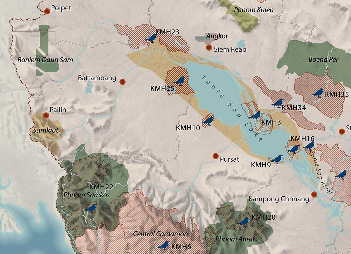
69 maps including lists with all meta data,
18 chapters including an authors
and contributors list,
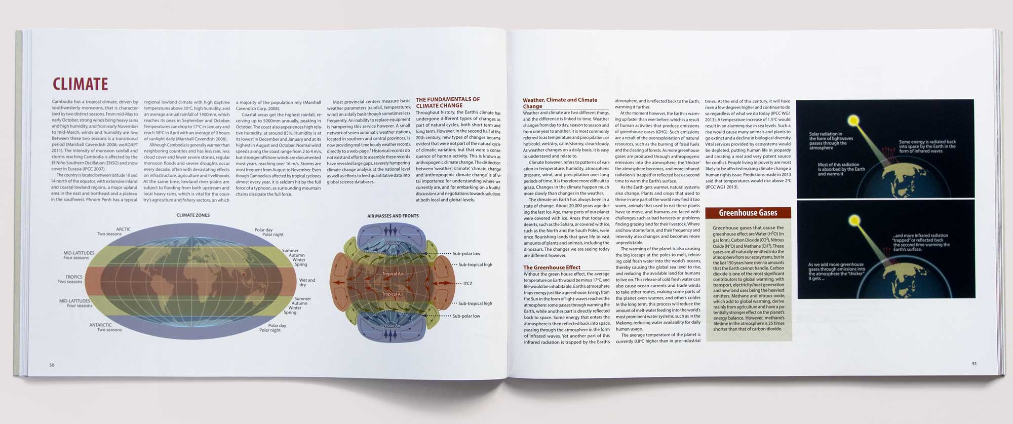
184 pages including photographs
and visual aids
(Visual Concept, Graphic Design and Layout, Mapping, Info-Graphic, Photography)